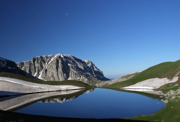
The mountainous area of Tymfi is located between the Aoos River and its tributary, Voidomatis, of the protected area of North Pindos. The tops of Tymfi are among the most popular mountaineering destinations and the highest ones from west to east are: Astraka (2436 m), Lapatos (2251 m), Ploskos (2388 m) Gamila (2497 m) Karteros (2251 (2467 m), Gouras (2466 m), Tsouka-Rosia (2380 m), Tzoumakos (2157 m), opposite in the region of Konitsa is Smolikas (2637 m) the highest peak of Pindos.
On a plateau of the mountain range of Tymfi is also Drakolimni at an altitude of 2050 m. The Tympis dragon is an alpine lake that owes its existence to the glaciers that existed in the area 10000 years ago and continues to be “fed” from the snow falling in the area.
It took its name from the Tritons (a rare species of amphibian lizard) living in its waters and resembling little dragonflies. There are many paths that one can follow to reach not only Drakolimni but also the tops of Tymfi.
There are two national paths that cross the protected area of Northern Pindos, “O3”, which connects seven villages of Zagori and Konitsa and “E6”, which connects five settlements of Metsovo and Grevena passing through the foot of Smolikas. These two paths are connected by two other paths (not marked by a single signage) that cross the Zagori and connect villages and areas of Tymfi. Finally there are other paths that are part of the “Z” networks (Zagori) , “P” (Pitech network of Metsovo), “OPE” (Operational Program Environment) and others with hardly any marks or unmarked at all.


